Orienteering Project
2. Make Your Map
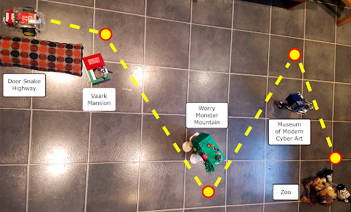
Make a physical map for the robot orienteer to navigate its way around by placing the objects that represent your landmarks on the floor.
MAP SIZE: An ideal floor area for your map is 2.5m x 2.5m or 10 feet x 10 feet. We don’t recommend you go much smaller than that but you can go bigger if you have space.
LANDMARKS: Place your landmarks on the floor in such a way that the robot orienteer can plot a route around them all.
WAYPOINTS: Decide on the location of your waypoints near each landmark. Mark these with a post-it note or a coin.
If necessary, adjust the positions of your landmarks and waypoints until you have a clear line of sight from each waypoint to the next, with sufficient space either side for your robot orienteer to drive through.